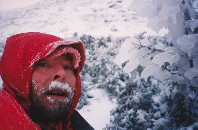
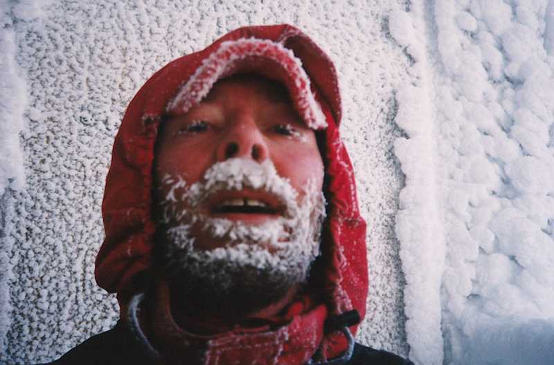
Self Portrait 800 feet below the summit on the first day of winter, 1999. Summit conditions that day were about average for winter; 40 below zero!
Mount Washington, the highest peak in the northeastern U.S, attains an elevation of 6,288 feet above mean sea level. Like most of my climbing buddies, I've climbed this thing a couple dozen times, and a few times in winter. If you are planning some serious expeditions in the Himalaya or other high places, this mountain is a great place to practice! Our best climbs have usually been in the winter when few others are on the mountain. It can be a dangerous world up there, but absolutely incredibly beautiful and surrealistic!
Self Portrait 800 feet below the summit on the first day of
winter, 1999. Summit
conditions that day were about average for winter; 40 below zero!
12/22/99; I took my glove off to take this self portrait
on the summit; my hand was frozen solid for the next hour! (click
here to see the actual summit weather for that day!)
I've also bivouacked near the summit 5 or
6 times. Don't bother using a tent up there; the wind will rip it to shreds!
Use a bivy sack instead. One weekend Ricky
and I were going to bivouac just below the summit, and Bob was with us.
Rick and I had full winter gear, but Bob had none. Ricky let Bob
borrow his summer sleeping bag so he could stay down low at Hojo's (Hermit
Lake Shelters, just below treeline). Bob wanted to stay up high with
us, but he only had the summer bag. Sure enough, he froze his butt
off!
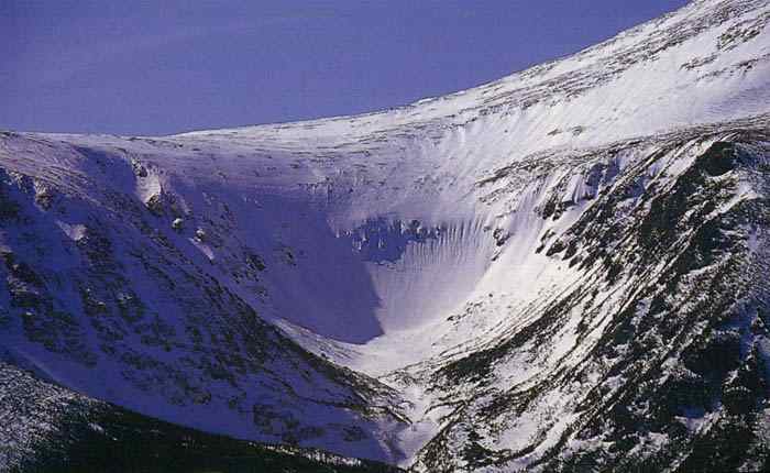
Photo of the famous Tuckerman Ravine, just below the summit.
People hike up and ski here, sometimes naked, all the way into July!
On another bivy, Dann, Ricky and I set up on the plateau just below the summit cone. The weather was nice, but it was summer, and very humid. When morning came, I poked my head out of my bivy sack, and could see nothing but fog. We were in the clouds! I yelled for those guys, but no one answered. I thought they were only about 6 feet away from me when I went to sleep. So I crawled a couple feet, still in my sleeping bag, and there they were. But the wind was howling so bad, and the fog was so thick, that I couldn't see six feet away! An hour later, it was still so thick that we almost had to crawl down to treeline along Edmunds Path.
The coolest summer ascent is up Huntington Ravine and across the Alpine Garden. But beware, that is just about the steepest trail in the whole White Mountain National Forest. If you do go up that way, and have lots of time left over, a great way down is along Boott Spur. It makes for a 12 hour day, but its an awesome loop.
Another great hike, and my first ascent, was up Ammonoosuc, and down Jewell. These are on the west side, and have the advantage of the late day sun. Excellent loop.
Caps Ridge trail, also from the west, is totally awesome! This trail starts at 3000 feet! Very cool!
I've bivied near Lake of the Clouds hut many times, usually in Spring while doing the Tuckerman Ravine Spring Skiing thing.
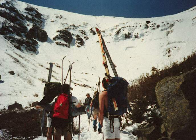
(We always get up to "Tuck's" for
the spring skiing at least once every April-June. Bring shorts and
a tee-shirt, and plenty of sunblock.)
Also did a couple bivies on Mt. Monroe, but if a storm comes in while you are up there, its all over!
Dann and I bivied once on the east side near Glen Boulder. During dinner, we watched the fog roll in, and rise up to slowly envelop everything below about 3000 feet. The undercast stayed all night, and all the peaks above 3500 feet were like "islands in the sky".
Once in the winter, Ricky and I got "lost" on the way down from the plateau above Tuckerman Ravine, and ended up wondering around up there until after midnight. We almost gave up and crawled into the single bivouac sack that we always carry, but Ricky had a real bad case of nasty farts all afternoon, so we decided not to give up looking for a way down until failing headlamps or safety forced us to halt. By two a.m. we had returned down to Pinkam, had snuck past the guard, and were asleep on the floor of the library. We were real happy to get down off the mountain that night!
We've done some nice Ice Climbs up in the ravines. Also some cool Winter Ascents. Our last attempt was the final day of winter in 1998. We needed full winter gear, including crampons and ice ax. We got part way up the summit cone, to within about 800 feet of the summit. The fog was thick, visibility was about 100 feet, and worst of all, avalanche conditions just below the summit were severe. All the parties were turning back, so we did too. We had an excellent winter climb that day, but the summit was not to be. Two weeks later I was up there in a tee-shirt! Go figure!
In my opinion, Mount Washington is truly the Grand Teton of the East!
Check out my Tuckerman Ravine page.
Page created and updated by Tim D; August 1999 Copyright©1999-2000